
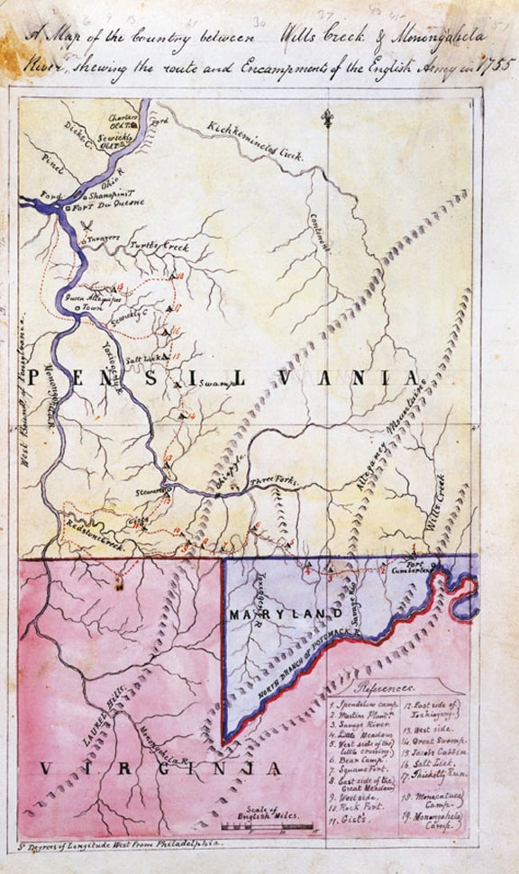
A Map of the Country between Wills Creek & Monongahela River shewing the route and Encampments of the English Army in 1755. Braddock Expedition Papers.
The big and robust Monongahela Rye Bitters
A Map of the Country between Wills Creek & Monongahela River shewing the route and Encampments of the English Army in 1755. Braddock Expedition Papers.